Publisher's Synopsis
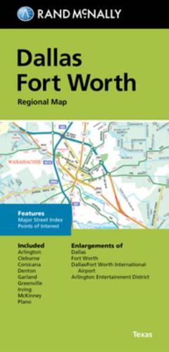
Rand McNally's folded map for Dallas Fort Worth is a must-have for anyone traveling in and around this part of Texas, offering unbeatable accuracy and reliability at a great price. Our trusted cartography shows all Interstate, U.S., state, and county highways, along with clearly indicated parks, points of interest, airports, county boundaries, and streets. The easy-to-use legend and detailed index make for quick and easy location of destinations. You'll see why Rand McNally folded maps have been the trusted standard for years. - Regularly updated. - Full-color maps. - Clearly labeled Interstate, U.S., state, and county highways. - Indications of parks, points of interest, airports, county boundaries, downtown & vicinity maps. - Major attractions & Golf Courses. - Enlargements of Dallas, Forth Worth, Dallas/Fort Worth International Airport, Arlington Entertainment District. - Easy-to-use legend. - Detailed index & Major Street Index. - Convenient folded size. Coverage Area Communities Included: Arlington, Cleburne, Corsicana, Denton, Garland, Greenville, Irving, McKinney, Plano. Product Details: Measures 9.5' x 4' and folds out to 40' x 28'.