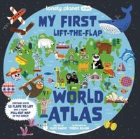
Publisher's Synopsis
This atlas uses computer-generated continental and regional maps to create a reference tool for home and school. From Afghanistan to Zimbabwe and from pole to pole, every country in the world is mapped in bright, clear colours that are easy to interpret and understand. An informative opening section examines the Earth's place in the Solar System, before a selection of world thematic maps throws light on our planet's ever-changing surface, its climate, vegetation and human population.;World physical and political maps introduce the main atlas section, which is organized by continent. A continental relief map heads each section. regions and individual countries are then mapped in greater detail. land relief is shown by both hill shading and an easy-to-read colour scale, while sea depths are indicated by a colour scale alone. A locator map shows the position of the country or continent in its world context and, for easy reference, each map includes national flags, lines of latitude and longitude, and a scale bar. Also included is a numbered and lettered grid which allows readers to find place names listed in the comprehensive index. Each map is accompanied by concise, accessible text containing physical, historical and cultural information about the country, region or continent shown.